Friday, May 30, 2008

Namche Bazaar - The last town before Everest

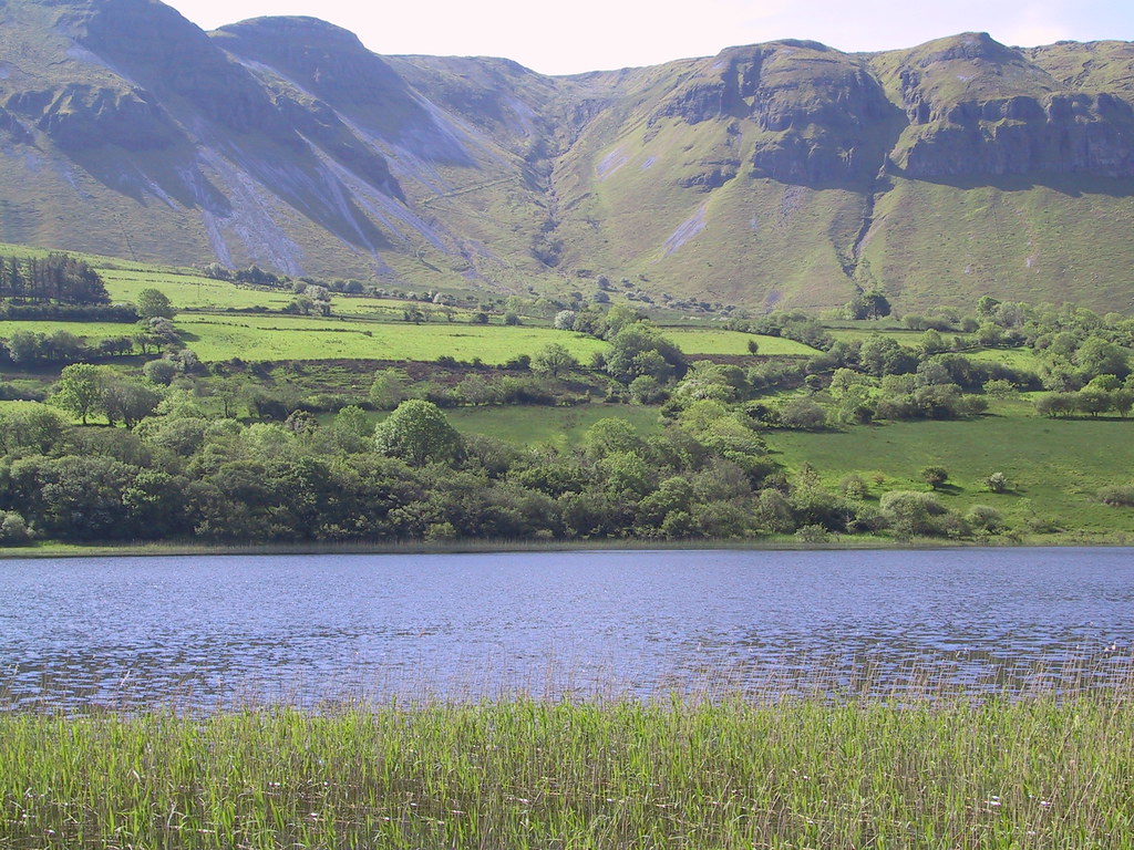
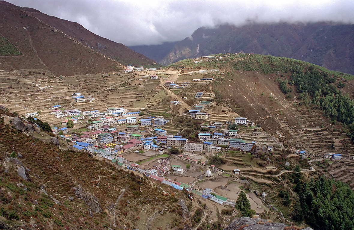
Namche Bazaar is a village in the Khumbu region of Nepal. Namche is located at 3,440 metres (11,286 ft) (the low point that is), populating the sides of a hill. Namche is the main trading center for the Khumbu region so there are many Nepalese officials, a police check, post and a bank.

Almost everyone trekking in the Khumbu region will visit Namche Bazaar, as it is the gateway to the high Himalaya. Visitors are likely stay at least one night, if not two for altitude acclimatization. The village has many shops and lodges where one can find almost anything required for trekking (no camera repair shops), although prices are higher than in Kathmandu. However, the higher you go up into the Khumbu, the more expensive everything gets so by the time you reach Lobuche (4,930m/16,175'), the prices in Namche will seem quite reasonable. Near the top of the village is the headquarters for Sagarmatha National Park as well as Nepalese army barracks. From the bridge over the Dudh Kosi, the trail winds its way up a "big" hill, finally cresting at a small building which also serves as an army/police check point.

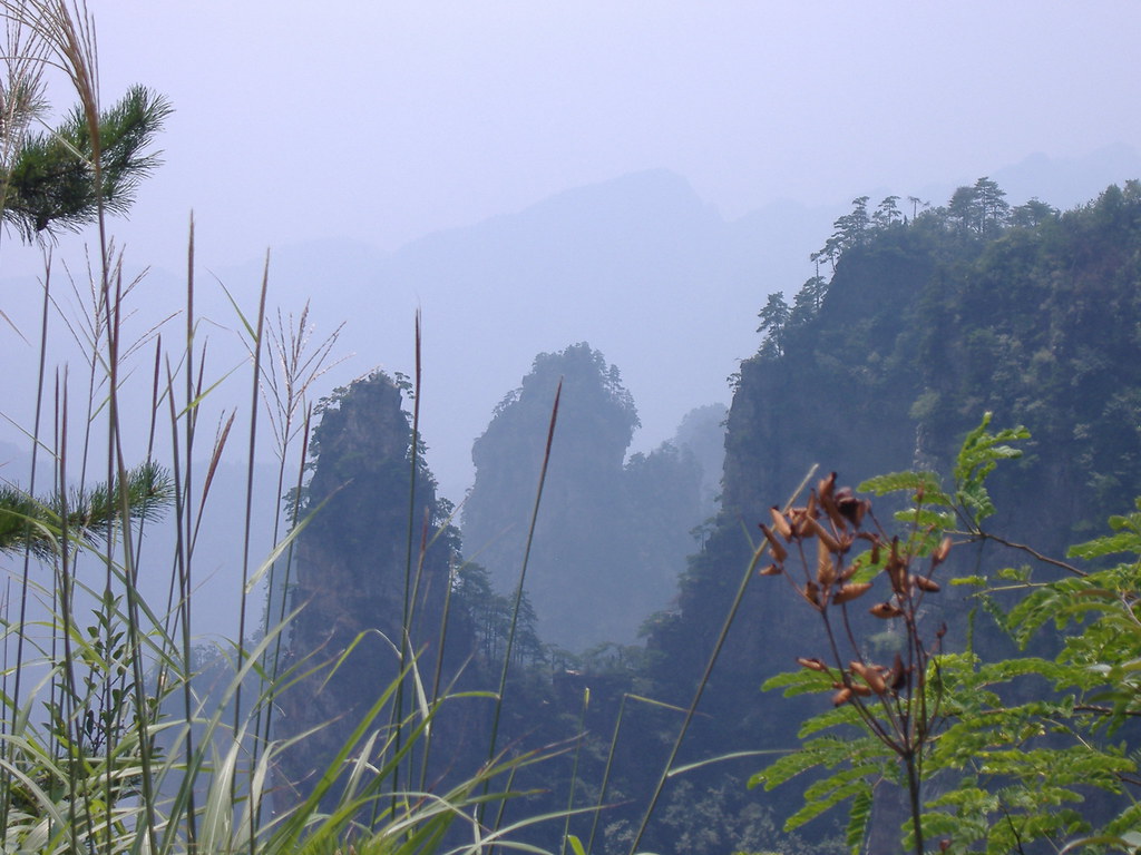
Many trekkers get up before sunrise and walk up to the Sagarmatha National Park Headquarters to take in the impressive views of Mount Everest, Lhotse, Thamserku, Ama Dablam (6,856m/22,493') and other magnificent peaks (though these can only be seen on a clear day) and to visit the museum. Pictures of peaks to the west from this vantage point such as Kongde Ri, cannot be taken as the army barracks are between you and these mountains. The army does not permit pictures to be taken of the barracks. Because of the proximity of the army barracks, the Sagarmatha National Park Headquarters is surrounded by a large amount of barbed wire.

A good acclimatisation walk from Namche Bazaar goes to Everest View Hotel, which is at an altitude of 3,800m / 12,467ft. As the name suggests, the hotel gives good views of Everest (when it is not enveloped in cloud) and this is generally considered the best view in the surrounding area. Everest View Hotel is a luxury hotel, which has had mixed success. Although the rooms are oxygenated, many guests have become sick. The hotel does, however, have the only decent restaurant serving western food in the region.

On Saturday mornings, a weekly market is held in the center of the village. People from all around the Namche area come to sell their wares, to locals and to visitors alike. The market usually starts around sunrise and begins to break up around 11 am. Also, there may be a daily Tibetan market where clothing and cheap Chinese consumer goods tend to be the main articles for sale. Tibetan merchants come to the market by way of high passes through the Himalayas.

Namche Bazaar has many internet cafés, making it the one of the few places in the region where trekkers can access the internet. The internet cafés connect via satellites and so the resulting connection speed is slow.

The village also contains a German bakery, well known in the region for providing good quality western food, including pizza.

credited to wikipedia

Thursday, May 29, 2008

Megastructures - Kansai International Airport - Japan

Kansai International Airport is an international airport located on an artificial island in the middle of Osaka Bay, off the shore of the cities of Sennan and Izumisano and the town of Tajiri in Osaka Prefecture, Japan. (It should not be confused with Osaka International Airport, which is closer to the city and now handles only domestic flights.) It was ranked 4th overall in the Airport of the Year 2006 awards named by Skytrax, next to Singapore Changi Airport, Hong Kong International Airport and Munich International Airport.

During FY 2006, KIX, which serves the city of Osaka, had 116,475 aircraft movements, of which 73,860 were international (31 countries, 71 cities), and 42,615 were domestic (19 cities). The total number of passengers was 16,689,658 of which 11,229,444 were international, and 5,460,214 were domestic. Freight volume was at 802,162 tonnes total, of which 757,414 t were international (18th in the world), and 44,748 t were domestic. The 4,000 meter runway 2 was opened on August 2, 2007. Kansai Airport has become an Asian hub, with 499 weekly flights to Asia, 66 weekly flights to Europe and the Middle East, and 35 weekly flights to North America.

In the 1960s, when the Kansai region was rapidly losing trade to Tokyo, planners proposed a new airport near Kobe and Osaka. Osaka International Airport, located in the densely-populated suburbs of Itami and Toyonaka, was surrounded by buildings; it could not be expanded, and many of its neighbors had filed complaints because of noise pollution problems.

After the protests surrounding New Tokyo International Airport (now Narita International Airport), which was built with expropriated land in a rural part of Chiba Prefecture, planners decided to build the airport offshore. The new airport was part of a number of new developments to revitalize Osaka, which had been losing economic and cultural ground to Tokyo for most of the century.

Initially, the airport was planned to be built near Kobe, but the city of Kobe refused the plan, so the airport was moved to a more southerly location on Osaka Bay. There, it could be open 24 hours per day, unlike its predecessor in the city. Local fishermen were the only group to protest, but they were silenced by hefty compensation packages.

A man-made island, 4 km long and 2.5 km wide, was proposed. Engineers needed to overcome the extremely high risks of earthquakes and typhoons (with storm surges of up to 3 meters). Construction started in 1987. The sea wall was finished in 1989 (made of rocks and 48,000 tetrahedral concrete blocks). Three mountains were excavated for 21 million cubic meters of landfill. 10,000 workers and 10 million work hours over 3 years, using 80 ships, were needed to complete the thirty-meter layer of earth over the sea floor and inside the sea wall. In 1990, a three-kilometer bridge was completed to connect the island to the mainland at Rinku-Town, at a cost of $1 billion. Completion of the artificial island increased the area of Osaka Prefecture just enough to move it past Kagawa Prefecture in size (leaving Kagawa as the smallest by area in Japan).

The bidding and construction of the airport was a source of international trade friction during the late 1980s and early 1990s. Prime Minister Yasuhiro Nakasone responded to American concerns, particularly from Senator Frank Murkowski, that bids would be rigged in Japanese companies' favor by providing special offices for prospective international contractors, which ultimately did little to facilitate the participation of foreign contractors in the bidding process. Later, foreign airlines complained that two-thirds of the departure hall counter space had been allocated to Japanese carriers, disproportionately to the actual carriage of passengers through the airport.

The island had been predicted to gradually sink as the weight of the material used to construct the island would cause it to compress downwards. However, by this time, the island had sunk 8 meters, much more than predicted. The project then became the most expensive civil works project in modern history after 20 years of planning, 3 years of construction and several billion dollars of investment. However, much of what was learned went into the successful artificial islands in silt deposits for New Kitakyushu Airport, Kobe Airport, and Chubu International Airport. The lessons of Kansai Airport were also applied in the construction of Hong Kong International Airport.

In 1991, the terminal construction commenced. To compensate for the sinking of the island, adjustable columns were designed to support the terminal building. These could be extended by inserting thick metal plates at their base. Government officials proposed reducing the length of the terminal in order to cut costs, but architect Renzo Piano insisted on keeping the terminal at its full planned length. The airport opened in 1994.

On January 17, 1995, Japan was struck by the Kobe earthquake, whose epicenter was approximately 20 km away from KIX and killed 6,434 people on Japan's main island of Honshū. The airport, however, emerged unscathed, mostly due to the use of sliding joints in its construction. Even the glass in the windows stayed intact. Later, in 1998, the airport survived a typhoon with wind speeds of up to 200 km/h.

On April 19, 2001, the airport was one of ten structures given the "Civil Engineering Monument of the Millennium" award by the American Society of Civil Engineers.

The total cost of Kansai Airport so far is $20 billion. This includes the land reclamation, 2 runways, and terminal and facilities. The additional costs were mostly borne initially due to the island sinking, expected due to the soft soils of Osaka Bay, but after construction the rate of sinking was considered so severe that the airport was widely criticized as a notorious structural engineering disaster. The rate of sinking has since fallen from 50 cm during 1994 to 9 cm in 2006.

Wednesday, May 28, 2008

Flood fears force huge evacuation - China, Sichuan and Shaanxi provinces

Just two weeks after a devastating tremor in which more than 68,000 lives were perished, a pair of powerful aftershocks on Tuesday collapsed hundreds of thousands of more homes in Sichuan and Shaanxi provinces, adding to the suffering of millions of local residents.

As the frequency of follow-up earthquakes does not bode well, a rising number of rural and urban households in Sichuan, its northern Shaanxi and eastern Chongqing municipality, have chosen to sleep outdoors in makeshift tents.

Many of the more than 400,000 homes that collapsed in Qingchuan County, Sichuan, and Ningqiang County, Shaanxi, on Tuesday, were somewhat already damaged by the initial May 12 magnitude 8.0 killer earthquake. Several dozens are reportedly hurt. The two quakes, on a magnitude of 5-plus and only half an hour apart, were a reminder that the crisis in the region and anxieties of the residents are unlikely to dissipate any time soon.

Flood fears force huge evacuation

More than 150,000 people who face the threat of flooding, should an earthquake-created dam near Beichuan burst its banks, were evacuated last night even as engineers were digging a diversion channel to prevent flooding.

Local authorities said they evacuated 158,000 people by midnight Tuesday in case Tangjiashan lake - formed when landslides blocked Jianjiang River after the May 12 quake - overflows its banks.

According to contingency plans, up to 1.3 million people from 33 townships of Mianyang city could be relocated if the lake barrier collapsed entirely.

Premier Wen Jiabao told a meeting of the State Council quake relief headquarters Tuesday that handling the quake lakes is the "most pressing" task at present.

The water level in the Tangjiashan lake has kept rising and the water diversion channel won't be effective till June 5, experts said Tuesday.

Tangjiashan lake was holding 130 million cu m of water - or the volume of water in about 50,000 Olympic-size swimming pools - said Liu Ning, chief engineer of the Ministry of Water Resources who was at the site to oversee the diversion work.

More than 600 engineers and soldiers were working nonstop at the lake site to dig the channel.

Cai Qihua, of the Yangtze River Water Resources Commission, said 26 excavators and bulldozers were being used around the clock.

The water is rising by nearly 2 m a day and reached only 23 m below the lowest part of the barrier Tuesday, she said.

Many towns and villages downstream held evacuation drills Tuesday.

In Tianlin village, among the first to be flooded if the lake bursts, gongs and loudspeakers directed 680 villagers to rush to surrounding hills within 20 minutes.

"The flood will sweep our village in 5 or 6 hours if the dam collapses," the village head said.

Jianjiang River runs into Fujiang River about 10 km north of the village.

Compounding flood fears, two fresh aftershocks struck quake-hit areas Tuesday.

A 5.7-magnitude aftershock struck Ningqiang county of Shaanxi province Tuesday at 4:37 pm. It was also felt in the provincial capital of Xi'an.

Earlier, at 4:03 pm, a 5.4-magnitude aftershock hit Qingchuan county in Sichuan, which is very close to Ningqiang,

The two aftershocks were also felt in the Sichuan provincial capital Chengdu and parts of Chongqing and Gansu.

More than 60 people were injured and 420,000 houses in Qingchuan collapsed in the aftershocks.

Qingchuan was the epicenter of a 6.4-magnitude aftershock on Sunday afternoon, which was the strongest aftershock since May 12.

The death toll from the quake reached 67,183 by midday Tuesday, with 361,822 injured and 20,790 missing, according to the Information Office of the State Council.

More than 45.61 million people were affected in the deadly quake, and about 15 million have been displaced, according to the office.

By noon Tuesday, donations in cash and relief materials from home and abroad reached 32.7 billion yuan ($4.7 billion). So far, 9.4 billion yuan ($1.35 billion) has been forwarded to the quake-affected areas, the office said.

Meanwhile, 566,400 tents had been sent to quake-affected areas by noon Tuesday, according to the Ministry of Civil Affairs.

credited to chinadaily.com

Tian Shan - China

The Tian Shan , also commonly spelled Tien Shan, and known as Tangri Tagh ("celestial mountains" or "mountains of the spirits") in the Uyghur language, is a mountain range located in Central Asia. The now widely used name Tian Shan is a Chinese translation of the Uyghur name, which may in turn go back to a Xiongnu name, qilian reported by the Shiji as the last place where they met and had their baby as in of the Yuezhi, which has been argued to refer to the Tian Shan rather than to the range 1,500 km further the east now known by this name. A nearby mountain range, the Tannu-Ola Mountains , also bears a synonymous name ("heaven/celestial mountains" or "god/spirit mountains").

The range lies to the north and west of the Taklamakan Desert in the border region of Kazakhstan, Kyrgyzstan and the Xinjiang Uyghur Autonomous Region of western China. In the south it links up with the Pamir Mountains. It also extends into the Chinese province of Xinjiang and into the northern areas of Pakistan, where it joins the Hindu Kush.

In Western cartography, the eastern end of the Tian Shan is usually understood to be just west of Ürümqi, while the range to the east of that city is known as the Bogda Shan. However, in Chinese cartography, from the Han Dynasty to the present, the Tian Shan is also considered to include the Bogda Shan and Barkol ranges.

The Tian Shan are a part of the Himalayan orogenic belt which was formed by the collision of the Indian and Eurasian plates in the Cenozoic era. They are one of the longest mountain ranges in Central Asia, stretching some 2,800 km eastward from Tashkent in Uzbekistan.

The highest peak in the Tian Shan is Jengish Chokusu which, at 7,439 metres (24,406 ft), is also the highest point in Kyrgyzstan and is on the border with China. The Tian Shan's second highest peak, Khan Tengri (Lord of the Spirits), at 7,010 m, straddles the Kazakhstan-Kyrgyzstan border. Mountaineers class these as the two most northerly peaks over 7,000 m in the world.

The Torugart Pass, 3,752 metres (12,310 ft) high, is located at the border between Kyrgyzstan and China's Xinjiang province. The forested Alatau ranges, which are at a lower altitude in the northern part of the Tian Shan, are inhabited by pastoral tribes speaking Turkic languages. The major rivers rising in the Tian Shan are the Syr Darya, the Ili river and the Tarim River. The Aksu Canyon is a notable feature in the northwestern Tian Shan.

One of the first Europeans to visit and the first to describe the Tian Shan in detail was the Russian explorer Peter Semenov in the 1850s.

credited to wikipedia and flickr users: kdriese, jurim, uncorneredmarket, ullrich, alan1954, evileve24, soleilune

Tuesday, May 27, 2008

Dubai night skyline

The modern emirate of Dubai was created consequent with the formation of the United Arab Emirates in 1971. However, written accounts documenting the existence of the city have existed at least 150 years prior to the formation of the UAE. Dubai shares legal, political, military and economic functions with the other emirates within a federal framework, although each emirate has jurisdiction over some functions such as civic law enforcement and provision and upkeep of local facilities. Dubai has the largest population and is the second largest emirate by area, after Abu Dhabi. Dubai and Abu Dhabi are the only two emirates to possess veto power over critical matters of national importance in the country's legislature. Dubai has been ruled by the Al Maktoum dynasty since 1833. The emirates' current ruler, Mohammed bin Rashid Al Maktoum, is also the Prime Minister and Vice President of the UAE.

credited to wikipedia

Thursday, May 22, 2008

Ben Bulben - Ireland

Ben Bulben (alternatively spelt Benbulben or Benbulbin) is a large rock formation in Ireland. It is a Ben (the Irish name for a large, glacier-carved rock). It is in the part of Ireland known as Yeats Country, though it is officially in the Irish county of Sligo.

Ben Bulben was formed during the Ice age, when large parts of the Earth were under glaciers. It was originally merely a large ridge, however the moving glaciers cut into the earth, leaving a distinct formation, now called Ben Bulben.

If climbed by the north face, it is a dangerous climb. That side bears the brunt of the high winds and storms that come in from the Atlantic Ocean. However, if climbed by the south side, it is an easy climb, due to the fact that side slopes very gently. Upon reaching the summit, the climber is rewarded with a magnificent view of Yeats Country.

Ben Bulben is the setting of many Celtic legends. It is said to be the dwelling of the Fianna, a band of warriors who lived in the third century. One example is a story in which the warrior Diarmuid Ua Duibhne (Diarmund) is tricked by the giant Fionn mac Cumhaill (Finn McCool) into fighting an enchanted boar, which later kills the warrior by piercing his heart with its tusk. The mountain is said to be Diarmuid and Grainne's resting places. Also, in the 6th century, St. Columba led 3,000 soldiers up Ben Bulben to fight for the right for the saint to copy from a Psalter he had borrowed from St. Finnian.

In September 1922, during the Irish Civil War, an Irish Republican Army column, including an armoured car were cornered in Sligo. The car was destroyed by another armoured car belonging to the Irish Free State's National Army , and six of the IRA soldiers fled up the Ben Bulben's slopes. In the end, all were killed, allegedly after they had surrendered. They are known as the "Noble Six"

credited to wikipedia and flickr users: theapothecaryguy, irishwebhq, madrarua, andrewparnell, tailwalker, vallhalla, joshua22, p_a_u_l, jhfoto, griangraf, robotparade, wandering-aengus, riverrun

Wednesday, May 21, 2008

Megastructures - Niagara Tunnel Project

The Niagara Tunnel Project is the most recent in a series of additions to the Sir Adam Beck hydroelectric generation complex in Niagara Falls, Ontario, Canada.

First constructed in 1922, the initial Sir Adam Beck power generating station, now abbreviated as SAB 1, derived its water supply from a canal connected to the Welland River. However, due to increased power demand in later years, a second generating station, known as SAB 2, was constructed in 1954. It in turn derives its water supply from two diversion tunnels, each about 9 kilometers in length. In 1958, a reservoir and the SAB Pump were constructed in order to make better use of available water by storing it during periods of low demand and using it in periods of greater demand in order to maximize the efficiency of the stations in regards to electricity supply and demand.

Between 1996 and 2005, Ontario Power Generation, which owns and operates the SAB complex, completed a series of major upgrades at the SAB 2 plant, increasing its potential generating capacity by 194 megawatts. Water delivered by the new Niagara Tunnel will complement this SAB 2 upgrade, and overall will increase the efficient use of the power of the Niagara River.

The Niagara Tunnel is being dug using a Tunnel Boring Machine, or TBM affectionately named "Big Becky" in honor of Sir Adam Beck. The machine will bore a hole about 10.4 kilometers long and about 14.4 meters in diameter under the City of Niagara falls from the Niagara River to the SAB complex. This massive undertaking will create about 1.6 million cubic meters of rock and debris, which is enough to fill Toronto's Rogers Centre baseball stadium to the top. The TBM operates about 140 meters below the ground, and as a result, the vibrations from the machine will not be felt on the surface. The design-build contractor for the project is Strabag AG, a large construction group with extensive experience in large tunnel construction. The tunnel is to be completed in 2010.

  • The tunnel creates enough clean renewable electricity to power a city twice the size of Niagara Falls. The generation capacity of SAB 2 will be increased by about 1.6 billion kilowatt hours per year. This is enough to power over 160,000 homes.
  • The tunnel is wider than 6 tractor-trailers side by side, and longer than 100 football fields.
  • The machine used in the construction of the Niagara Tunnel can bore through over 15 meters of solid rock per day.
  • Over 500 cubic meters of water will enter the Tunnel per second.
  • 400,000 cubic meters of concrete are used to line the inside of the Tunnel.
  • It will take about 3 years to construct the Niagara Tunnel.
  • The tunnel is 14.4 meters in diameter — 65 percent wider than the Channel Tunnel, which is 8.6 meters in diameter, and 2.5 times wider than the subway tunnels in Toronto, Canada which is 5.7 meters in diameter.
  • Once completed, the Niagara Tunnel will be the largest hard rock tunnel in the world.
  • The machine requires 7 megawatts of electricity — enough to power the United Nations Building in New York City.
  • The machine uses 85 watermelon-sized cutting teeth on the face and each tooth weighs as much as a male gorilla.
credited to niagarafrontier.com

Tuesday, May 20, 2008

A small island in Lower Saranac Lake in the Adirondacks in the U.S.

Lower Saranac Lake is one of three connected lakes, part of the Saranac River, near the village of Saranac Lake in the Adirondacks in northern New York. The Saranac Lake Islands Public Campground provides 87 campsites on inlands in Lower and Middle Saranac Lake. In addition to the Saranac River, it is fed by nearby Lake Colby, Fish Creek, and Lilly Pad Pond.

Monday, May 19, 2008

Rainbow Over Blue Ice

A glacier is a large, slow moving river of ice, formed from compacted layers of snow, that slowly deforms and flows in response to gravity. The processes and landforms caused by glaciers and related to them are glacial (adjective); this term should not be confounded with glacial (noun), a cold period in ice ages (see glacial period). The process of glacier growth and establishment is called glaciation.

credited to wikipedia and flickr user niallcorbet

Sunday, May 18, 2008

Erta Ale - Ethiopia

Erta Ale is an active shield volcano located in the Afar Region of northeastern Ethiopia. It is the most active volcano in Ethiopia. Erta Ale stands 613 metres tall, with a lava lake, one of only four in the world, at the summit. It is located in the Danakil Depression, a desert area spanning the border with Eritrea.

Erta Ale's last major eruption was in 2005, when thousands of nearby residents were forced to flee. Additional lava flow activity took place in August 2007, forcing the evacuation of hundreds and leaving two missing.

credited to wikipedia and flickr users: filippo_jean, geo_decouverte, zeddy1200, volcanoes, nutzAgnes