Wednesday, August 13, 2008

Uluru (Ayers Rock) - Australia

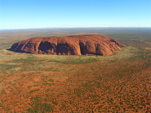
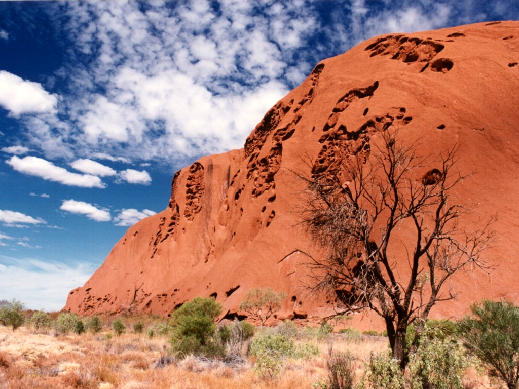
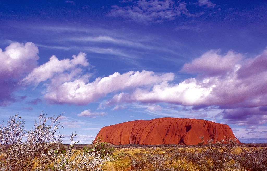
Uluru, also referred to as Ayers Rock, is a large sandstone rock formation in the southern part of the Northern Territory, central Australia. It lies 335 km (208 mi) south west of the nearest large town, Alice Springs; 450 km (280 mi) by road. Kata Tjuta (The Olgas) and Uluru are the two major features of the Uluru - Kata Tjuta National Park. Uluru is sacred to the Pitjantjatjara and Yankunytjatjara, the Aboriginal people of the area. It has many springs, waterholes, rock caves and ancient paintings. Uluru is listed as a World Heritage Site.

Uluru is one of Australia's most recognisable natural icons. The world-renowned sandstone formation stands 348 m (1,142 ft) high (863 m/2,831 ft above sea level) with most of its bulk below the ground, and measures 9.4 km (5.8 mi) in circumference. Both Uluru and Kata Tjuta have great cultural significance for the Aṉangu Traditional landowners, who lead walking tours to inform visitors about the local flora and fauna, bush foods and the Aboriginal dreamtime stories of the area.

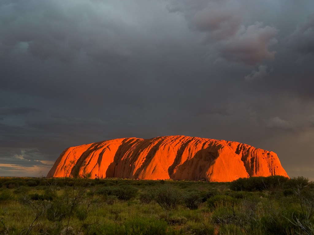
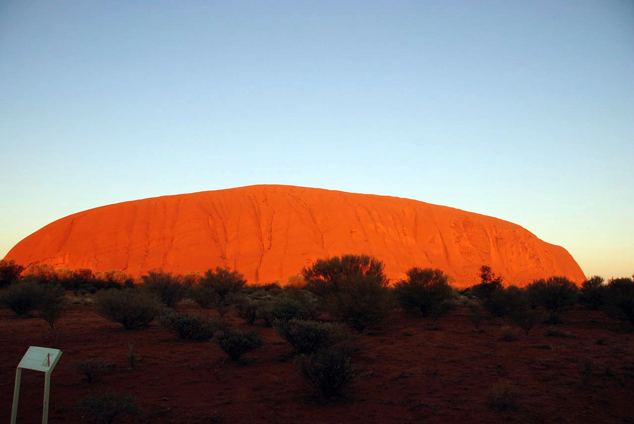
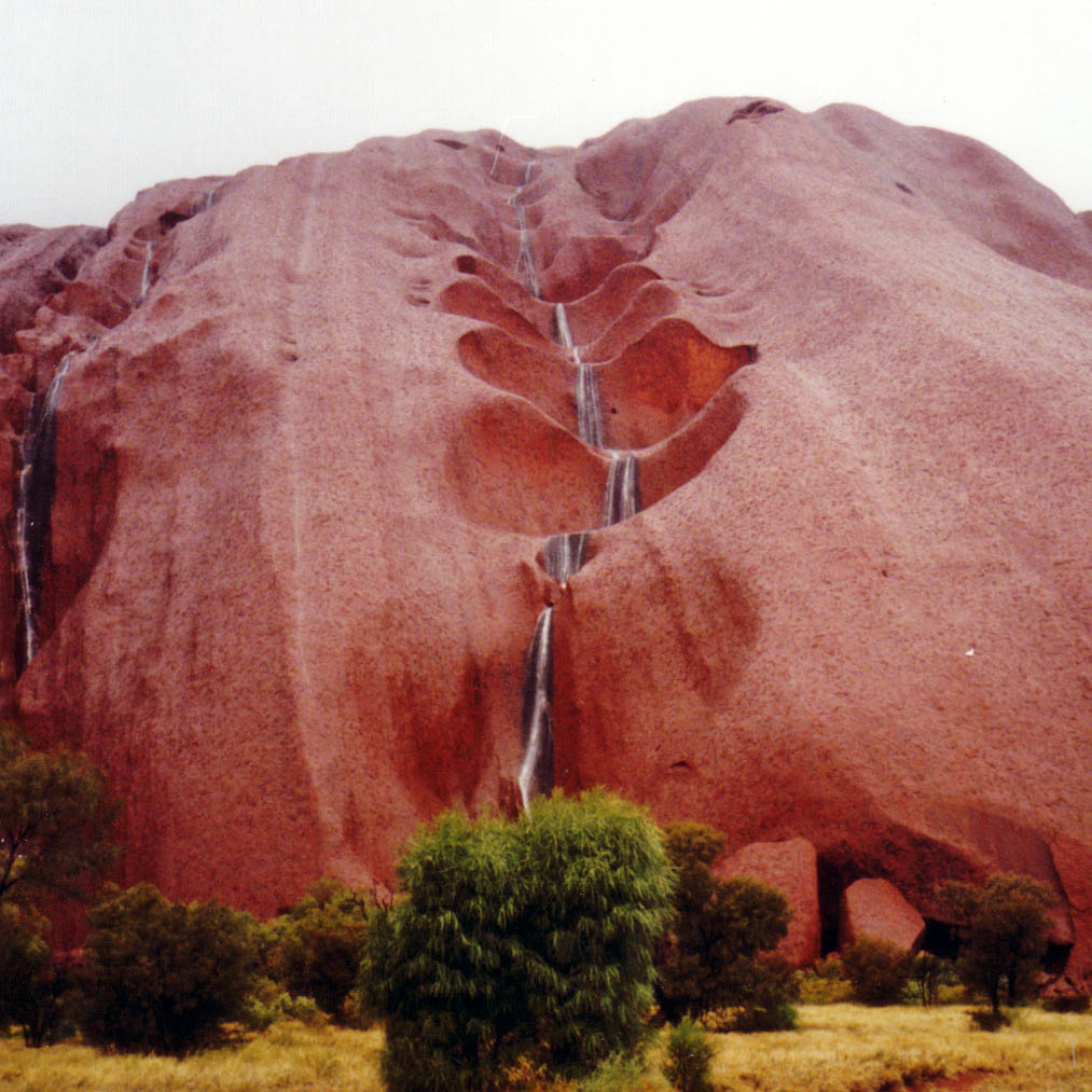
Uluru is notable for appearing to change colour as the different light strikes it at different times of the day and year, with sunset a particularly remarkable sight when it briefly glows red. Although rainfall is uncommon in this semiarid area, during wet periods the rock acquires a silvery-grey colour, with streaks of black algae forming on the areas that serve as channels for water flow.

Kata Tjuta, also called Mount Olga or The Olgas owing to its peculiar formation, is another rock formation about 25 km (16 mi) from Uluru. Special viewing areas with road access and parking have been constructed to give tourists the best views of both sites at dawn and dusk.

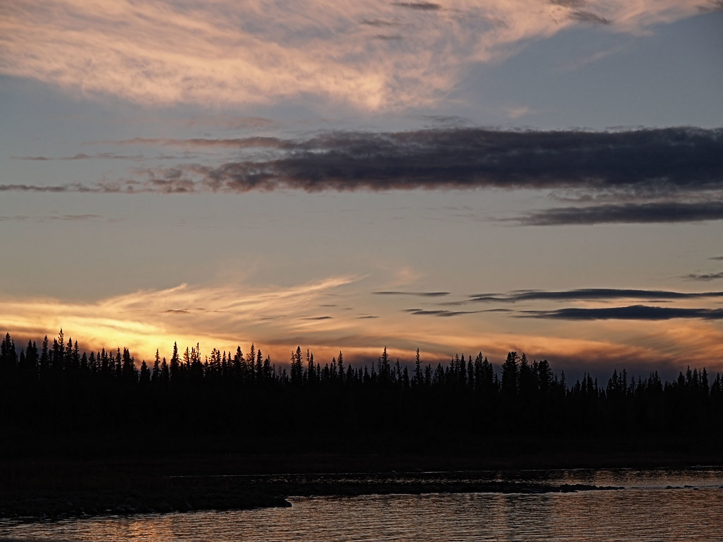
credited to wikipedia and flickr users: andrew, peternijenhuis, jonathansabin, yewco, markeveleigh, vtveen, the_guenni, pedroqtc, vtveen

Tuesday, August 12, 2008

Mackenzie River - Canada

The Mackenzie River originates in Great Slave Lake, in the Northwest Territories, and flows north into the Arctic Ocean. It is the longest river in Canada at 1,738 km and, together with its headstreams the Peace and the Finlay, the second longest river in North America at 4,241 km in length. The Mackenzie and its tributaries drain 1,805,200 square kilometers. Its mean discharge is 9,700 cubic metres per second.

The large marshy delta of the Mackenzie River provides habitat for migrating Snow Geese, Tundra Swans, and Brant as well as breeding habitat for other waterfowl. The estuary is a calving area for Beluga whales.

The river is navigable for approximately five months of the year. It freezes over in October and the ice on the river breaks up in May. During the winter months, sections of the river are used as an ice road.

During the ice-free period the river is navigable over its entire length. Barge traffic from an intermodal hub at the railhead at Hay River serves much of the Western Arctic.

The Mackenzie (previously Disappointment River) was named after Alexander Mackenzie, who travelled the river while trying to reach the Pacific Ocean in 1789. In the Dene languages it is called Deh Cho.

The divide between the Mackenzie basin and the basin of the Yukon River to the west forms the central portion of the boundary between Northwest Territories and the Yukon.

In 2008, Canadian and Japanese researchers extracted a constant stream of natural gas from a test project at the Mallik methane hydrate field in the Mackenzie delta. This was the second such drilling at Mallik: the first took place in 2002 and used heat to release methane. In the 2008 experiment, researchers were able to extract gas by lowering the pressure, without heating, requiring significantly less energy. The Mallik gas hydrate field was first discovered by Imperial Oil in 1971-1972.

credited to wikipedia and flickr users: opalmirror, anna154, evenelsewhere, jbbar, gslside, wiless, mfitch, eclecticblogs, jksnijders, nadiabob