 The Ténéré is a desert region in the south central Sahara. It comprises a vast plain of sand stretching from northeastern Niger into western Chad, occupying an area of over 154,440 square miles (400,000 km²). Its boundaries are conventionally said to be the Aïr Mountains in the west, the Ahaggar Mountains in the north, the Djado Plateau in the northeast, the Tibesti Mountains in the east, and the basin of Lake Chad in the south.
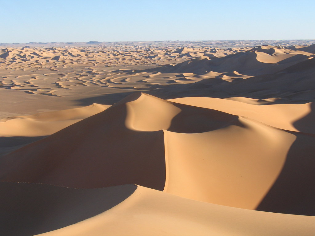
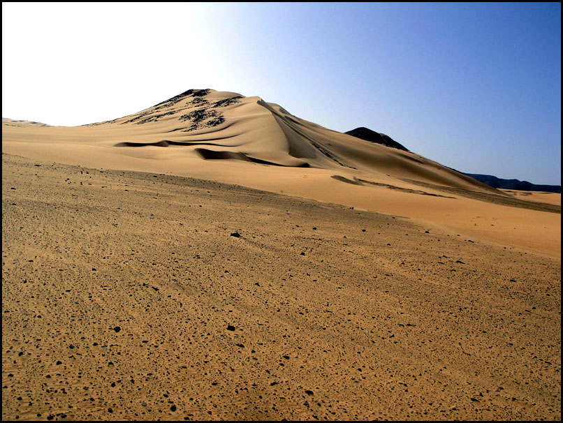
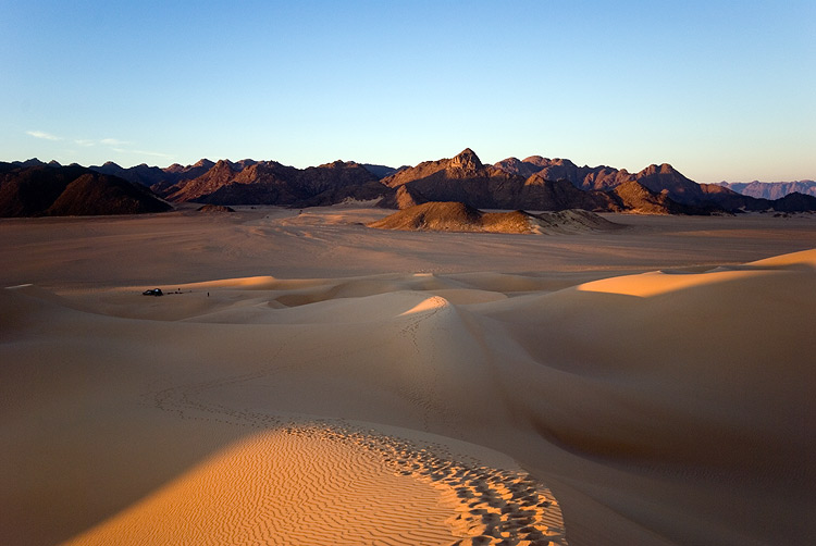
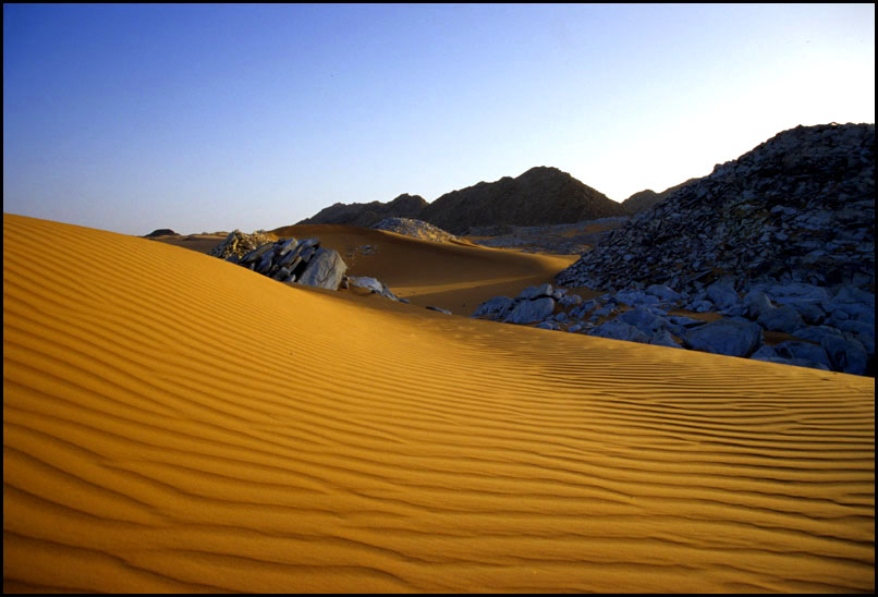
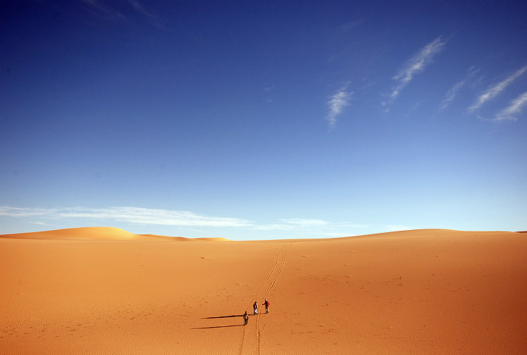 Most of the Ténéré is a flat basin, once the bed of the prehistoric Lake Chad. In the north, the Ténéré is a vast rock strewn plain (called a Hamada), periodically broken by ancient volcanic hills. In the south, is the Erg of Ténéré, a great dune sea which, with the Erg of Bilma to its east, forms rows of shifting dunes, some as high as 40 meters. To the west, the Aïr Mountains rise up, in some places with the dune seas meeting cliff-faces. To the east-south east, Ténéré is bordered by the Kaour cliffs, which form a leeward side chain of oases over a more than 100 km north to south line. Periodic mountain peaks, like the Blue Mountian in the north, or the Agram hills protecting the oasis of Fachi in the south, are rare but notable landmarks.
 The region was not always a desert. During the prehistoric Carboniferous period it was a sea floor and later a tropical forest. A major dinosaur cemetery lies at its western edge; many fossils have been found there, having eroded out from the ground. An almost complete specimen of the crocodile-like reptile Sarcosuchus imperator, nicknamed the SuperCroc, was discovered there by paleontologists. During early human history, it was a fertile land much more congenial to human life than it is now. The region was inhabited by modern humans as long ago as the Paleolithic period some 60,000 years ago. They hunted wild animals and left evidence of their presence in the form of stone tools. During the Neolithic period about 10,000 years ago, ancient hunters created rock engravings and paintings that can still be found across the region. The human population dwindled as the Sahara dried out, and by 2500 BC it had largely become as dry as it is today.
 The Ténéré is very sparsely populated. The modern inhabitants of the Ténéré are largely Tuareg of Ayr and Azawagh. Three Tuareg federations, Kel Ayr, Iwillimidan Kel Denneg and Kel Gres ruled the area until the arrival of the French colonial army, which occupied the land. Other ethnic groups dwelling in the Ténéré are the Hausa, Songhay, Wodaabe, the Moors, and Tebu.
The desert is also known for the celebrated Tree of Ténéré, once the most remote in the world. The tree was knocked down by an allegedly drunk Libyan truck driver in 1973, despite being the only tree for several hundred kilometres. It was replaced by a metal sculpture. Despite this unfortunate mishap, the tree is still often indicated on maps of the region as a notable landmark.
credited to wikipedia and flickr users: nygus, ianna, yelema, mike in croydon, willemstom


3 comments:
wowwwwww
As always an excellent posting.The
way you write is awesome.Thanks. Adding more information will be more useful.
Bathmate
This information is very interesting, I really enjoyed, I would like get more information about this, because is very
beautiful, thanks for sharing! costa rica investment opportunities
Post a Comment